Blog Roddus

Blog Roddus
My Favorite Place

Monday, July 12, 2004

Mt Oxford - Date Unknown

Uncle Roddus Tramping diary:Tramp No 47
Mt Oxford - Date Unknown


Another trip up my nearest mountain and another with the CTC. This tramp took place sometime in the winter of 04'. Left Coopers Creek at 9:20AM on a cool overcast day, with the intention of doing the Oxford loop. During the ascent the cloud lowered and the rain and hail hit and by the time we made the summit at about 12:30PM it was snowing on the top with strong wind just to make it more unpleasant. Suffered through lunch and abandoned plans to carry on and do the loop, just headed back down the way we came. Back at cars about 3pm.

No photos from this trip.

Sunday, April 25, 2004

Mt Olympus to Mt Enys - 25th April 2004

Uncle Roddus Tramping Diary:tramp No. 46
Mt Olympus to Mt Enys 25th April 2004


This was a slightly insane trip with the CTC with the original intention of a moderate days walk up to Mt Olympus and onto Cheeseman and back to the car. A foggy day on the Planes but a stunning day on the Cragiburns, we had conqured Olympus by 11:30am and bagged Cheesman by 1:00PM. Some fool uttered the comment that we could possibly get all the way to Enys and that they hadn't been to Enys. The group took this on as a challenge with Uncle Roddus tagging along at the rare, not wanting to be the one to pike out, set off a brisk pace. Izard wizzed by and then Cloudsley and finally we made Enys with Uncle Roddus the last to arrive at each peak and so not getting much of a rest. We then backtracked along the ridge from Enys and dropped down the scree that we had come down the on the earlier trip up Enys and Uncle Roddus(who loves a good scree) was the first one to the bottom and we got back to the cars by 6:00PM. Approx 23KM traveled with an estimated height gain of  around 2300M. A don't have the start time, but depending on what time they left town we may have got away on the climb to Olympus just after 9:00am, but in light of the original tramping route, I would have thought that the the usual start time would have been sufficient and therefore it would be unlikely we would have been on track quite so early, so the travel time, all up, is probably somewhere between 8 and 9 hours. Not the longest day I have done, but certainly the hardest.
I Cannot find any photos from this trip probably due to the fact that there was no time to take any.

Saturday, April 17, 2004

Steepface Hill - 17th April 2004

Uncle Roddus Tramping Diary: Tramp No.45
Steepface Hill 17 April 2004


Just the three of us did this CTC trip to Steepface hill which is on the true right of the Rakia River, just south of Black Hill, which I had also done recently, and just north of Mt Hutt. We left the car at Hutt stream on a mild day with a bit of high cloud. Headed up Hutt stream and then ascended to point 1574 where we had a short break and admired the views. The wind, although not too strong, was a bit cold, so we headed on quickly north to Steepface itself at 1876. After Lunch, we headed along the spur to point 1488 before trying to find a scree that would take us directly down to the road. Unfortunately, we didn't sidle left enough around the face of the hill and didn't find that scree and so ended up having to crash our way through the matagari at the bottom of the hill. A good climb of about 1500M and around 10KM traveled.


The view down Hutt Stream to the Rakia River.
The back view from point 1574


Pit stop at point 1574 with out destination in the background.
View of Rakia River, Peak hill, Mt Oakden and a bit of Lake Coleridge.


Monday, April 12, 2004

Mt Binser - 12 April 2004

Uncle Roddus Tramping diary:Tramp No. 44
Mt Binser - 12th April 2004


The last time I tried this trip, one of the cars broke down and so we were late getting started and we ran out of time to get to the summit. My friend Bryce and myself decided to tackle this hill on this fine day and there was a bit of snow awaiting us on the tops. Got started about 10:15AM and headed up the track to the Binser Saddle.
From the saddle we headed south for a short easy bush bash before the nice steep climb up to point 1753, where we enjoyed lunch. The snow was soft, so didn't need crampons, but the wind was cold, so we had to rug up. Carried on along the sharp ridge in the snow to the next point to the South-east, then a bit of a dip before cresting Binser itself at 1860M. The views were magnificent. Made the summit around 3:00PM. From the summit, we dropped directly down the spur from the top heading west and dropping straight down to the road and then a tiring 4KM slog back to the car along the road. A day of  just over 1300M height gain and about 16KM.

One of the Views

Just a nice touch of snow.

More of the views.

Still climbing.

Bryce on the Tops.

A nice day.


Did I mention we had some nice views.

Bryce in the snow

The route along the tops

"You go get car, I'll just wait here"


Sunday, April 4, 2004

Amber Col - 3-4th April 2004

Uncle Roddus Tramping dairy: Tramp No.43
Amber Col - 3-4th April 2004


Another trip in this very active period with the CTC, this time an overnight one. The intention, from memory, was to head up the Hawdon river, Walker pass and onto Amber Col, camping high(I,m not sure where) and then along the tops on Sunday, dropping down Sudden Valley and back to the cars.
 We did as planned, leaving the car at Hawdon shelter, five of us getting to Hawdon hut in about 2 hours for morning tea around 11am. We got to Walker pass about 1:00PM, by which time the wind had picked up and the temperature had dropped as well as cloud build up. We lunched just below the Pass. From Walker pass we followed the East branch of the Otehake river up to Amber Col. With the weather deteriorating, as forecast and rain and possible snow expected overnight, our leader decided to abandon the idea of a high camp and head down and camp near the Edwards river. 
 The weather did as predicted and it was still raining when we awoke the next day with fresh snow on the tops. We abandoned any ideas of heading back over the tops into sudden valley and instead just walked out down the Edwards, thus facilitating our driver in hitching back to the car at Hawdon shelter.

It seems I wasn't too keen on taking too many photos at this time, possibly because I didn't have a carry bag I could clip to my pack belt like I do now and so I had to get the camera out of the pack every time I wanted to shoot a photo. I only have 15 photos from this trip(normally, these days, I would take at least a couple of hundred) and these are the best of them.


Sunday, March 14, 2004

Black Hill - Rakia - 14th March 2004

Uncle Roddus Tramping diary: Tramp No. 42
Black Hill, Rakia - 14 march 2004


Five CTC trampers took on this challenge of a harder trip to climb another 2000M+ peak, with this Black Hill being the one on the true right of The Rakia River. We left the car about 9:45am and followed the four wheel drive track around the back of the quarry and Redcliff hill before the tackling the steep climb up the ridge behind Redcliff. Uncle Roddus was soon left well behind by some of the fastest in the club and didn't catch them again until after lunch and the making of the summit. After this we dropped off down a scree, although I am not quite sure where now, but we ended up in the creek just south of the summit, from where we followed that down to the hut and then back along the four wheel drive track to the car. According to my diary we walked about 18KM, although I'm not sure of the exact route now, but to do 18KM, we may have headed round to point 1971 before dropping down into the creek, other wise, if we came straight off the summit, we may have only walked about 16KM. With a height gain from the road of about 1600M, this was a fairly big day. Got back to the cars around 5:30PM.

This is the only photo I have from this trip. Thats me in the red, on the summit. It seems my camera must have been out of action for this group of trips, or they were so fast that I didn't have time to take any pictures.

Sunday, March 7, 2004

Mt Catherine - 7th March 2004

Uncle Roddus Tramping diary: Tramp No. 41
Mt Catherine - 7th march 2004


As per most of my trips, this was another day expedition with the CTC. Mount Catherine is a  good, nearly 1400M, climb up to a 2085M peak overlooking Lake Heron. A party of nine trampers left the cars near the station house at the end of the road at the north end of Lake heron on a warm day with low clouds sitting over the valley. Following the farm track for a couple of KM, we then headed of up the Northern spur via point 1877 from which we got great views of the tops of the clouds sitting over the lake. Continuing on, we got to the summit about 1:30PM after 3.75 hours and just over 7KM. Enjoyed lunch in the sun with great views right down to Mt Cook, before continuing round over point 2045 and then dropping down the scree into Home Creek. Followed the creek back to the farm track then onto the cars, by which it was about 4:30PM. Just under 7 hours and 15KM.

Another trip with no Photos. The route marked in black is from a later trip I did.

Saturday, February 21, 2004

Warfdale Track - 21st February 2004

Uncle Roddus Tramping Diary: Tramp No.40
Warfdale Track - 21/2/2004


Originally a CTC trip to climb Mt Oxford, but being a wet and wild windy North Westerly day we abandoned that plan and took a stroll along the Warfdale track to the saddle, had a cold and wet lunch and headed back out again. No photos of this trip.

Thursday, February 12, 2004

The Five Passes: Mt Aspiring National Park 7-12th Febuary 2004

Uncle Roddus Tramping Diary: Tramp No. 39
The Five Passes: Mt Aspiring National Park  7-12th Febuary 2004

Here we are in the depths of winter and due to work commitments, weather conditions, other commitments and my general lack of enthusiasm for going bush in the freezing cold of winter (My body and mind feel they should be hibernating), I haven't been out tramping since late May and so I thought it time to blog one of the classic trips I did in the past.

 
This trip was suggested to me by my tramping buddy, Bryce, in late 2003 and at first I was uncertain as to whether I was up to it, as I was still fairly inexperienced in tramping. After doing Ball Pass a few weeks earlier i decided that I could handle it and Bryce had proved to me that he was and experienced person, as well as being a Doctor, I felt more reassured.
We left town on the 6th for the 6/7 hour drive to the Routeburn Shelter, where we spent the night. We left the shelter on the first day around 8:30am to a warm and slightly overcast day, our first target being Sugarloaf Pass(No.1). We made the pass in about 2 hours, stopped to enjoy the views and then proceeded to drop back down to the Rock Burn river. A good 4 hours of pleasant travel through Red Beech forest brought us to our first camping spot amongst the trees at Theater Flats. A great camping spot, with a couple of other groups dotted around the trees and a plague of sand flies to annoy us as we set up camp and cooked tea.

Preparing to leave the Routeburn Shelter
 Coming up to Sugarloaf Pass.
 Heading away from Sugarloaf Pass to drop down into the Rockburn.

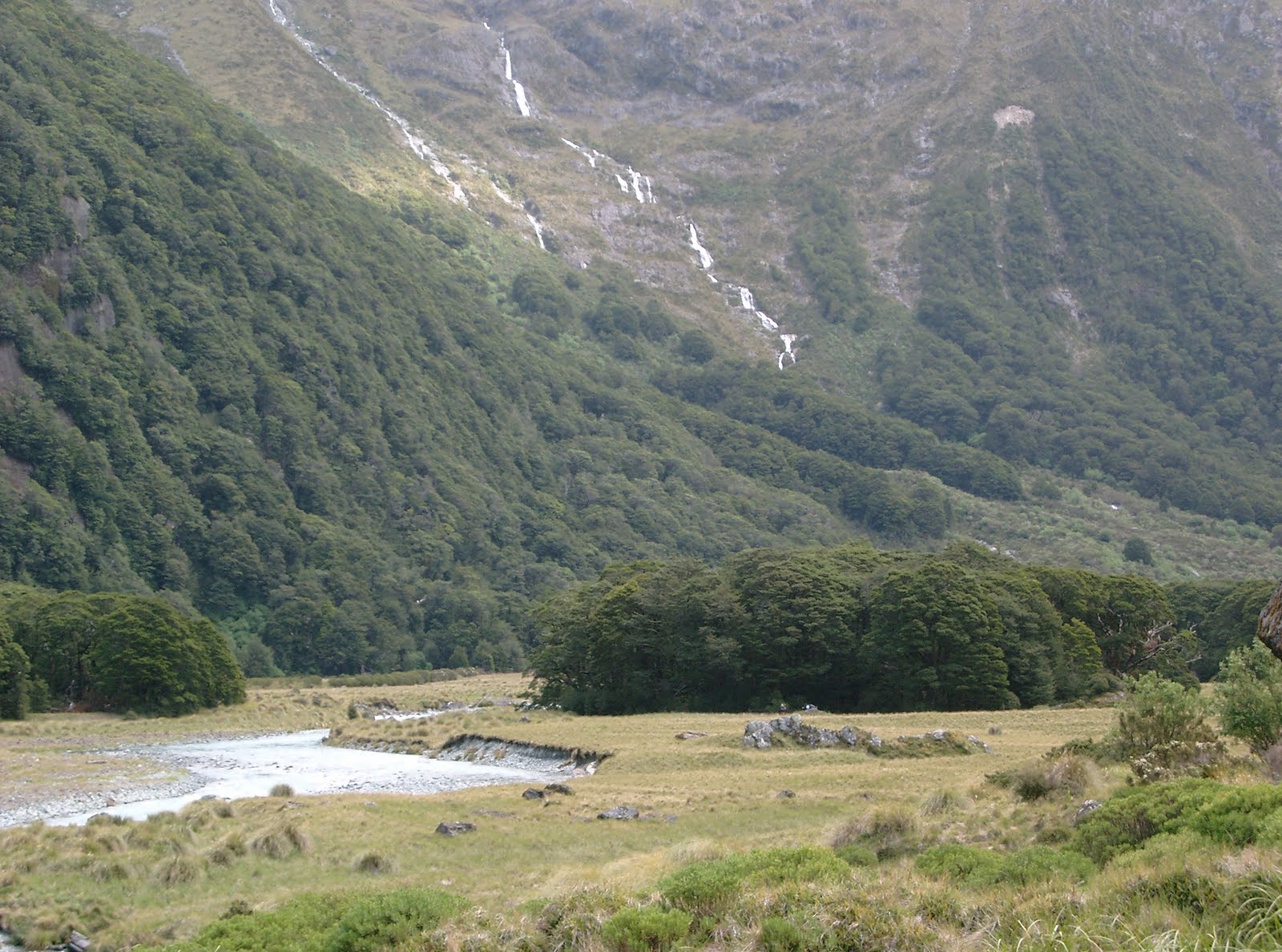
Looking up the Rockburn

Theater Flat and looking at the copse of trees where we camped.

Me preparing dinner and trying to keep the sand flies off.

Looking out from our camping spot.

A waterfall
Day two was the same weather wise as we continued up the Rockburn from Theater flats and crested Park Pass(No.2) and then dropped down into Hidden Falls Creek where we spent the rest of the day travelling first through bush, then scrub and tussock and then a pretty rocky assent over Cow Saddle(No.3) after which we spent some time looking for the rock biv we were to stay in that night in the shadow of Tantalus Peak. A bit more challenging day than the first but a similar time spent traveling.

 Leaving Theater Flats

 There were a few small hills in the area

A Rock Biv we encountered on the Rockburn

 Meandering through the rock and tussock heading up to park pass


I think this is looking back down the Rockburn from near Park Pass

The Tarn on Park Pass

 Looking the other way from the tarn

 Are we there yet?


The rocky end of Hidden Falls Creek heading to Cow Saddle


Our Home For The Night

Day Three again dawns fine with no hint as to what was to come. We climbed the steep assent up to Fiery Col(No.4), our highest crossing so far and managed to sneak across the last vestiges of last winters snow with out the aid of crampons. rested at the col, before dropping down to the Olivine ledge and sideling round to below the Fon lakes. The Temperature was taking a sharp descent by this time and as we got to the campsite below the lakes we were deciding weather to carry on up to the lakes to camp or carry on  along the ledge to another rock biv we had been told about. A sudden increase in the wind and a closer look at the encroaching cloud bank enforced a decision pretty quick if we didn't want to be walking and setting up camp in the pouring rain. A hasty camp was set and we just managed to get set up and crawl into the tent as the downpour hit. we are talking Noah here, with some pretty good wind in support. Poor Bryce was the one who had to go out in it to boil the water for dinner, as it was his MSR we were using and I didn't know how to get it going(that was my excuse anyway. Dehydrated meals were heated and consumed in the tent and the empty packets used as urinals, cos by this time even Noah wouldn't have gone out there. The rain and wind never let up through out the night untill about 6am the next morning and we finally got to get some sleep.

 
Heading off to Fiery Col

The last of the winters snow

 Looking down to the olivine ledge

Heading across the olivine ledge to our next campsite.

It's gonna rain any time now.

 The next morning like nothing had happened.


Woke up on day four to the beautiful blue of a cloudless sky and luckily had the luxury of time to allow all our stuff to dry out as it wasn't going to be too long a day to our next camp. After a dip in the cold creek feeding out of the Fon lakes, to freshen up after 4 days of no showers, we broke camp at about midday and embarked on the short climb you see above to the Fon lakes. After admiring the lakes and putting on some more layers of cloths, as the temperature was dropping again, we headed off to Fon Saddle(No.5). From From Fon saddle it was a steep and slippery descent through snow grass down into the Beansburn valley and then follow the river downstream to the large RockBiv


The Larger of the Fon Lakes
 
 And The smaller one.
Looking down on the Beansbern.

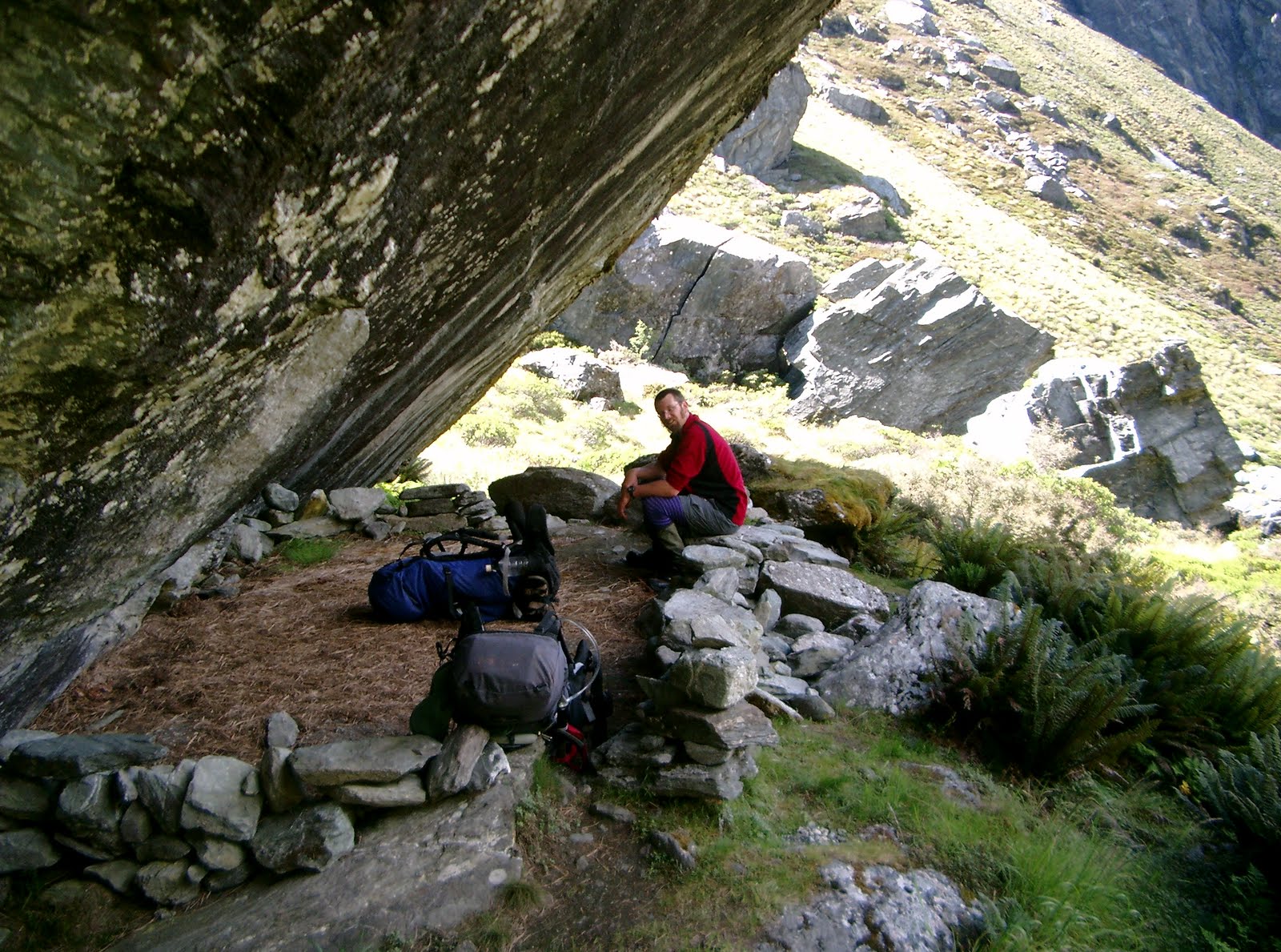
 Nearly Home, that large rock in front of me is to be our home for the night.
This rock biv had several rooms and levels. Unfortunately the lower levels had been used as a rubbish dump by many lazy and unscrupulous trampers.
This was where I slept and notice the little brown mouse on the rock at the top right. The little buggers were running over my sleeping bag and trying to get into my pack while I was trying to get to sleep. I put some cheese out further towards the entrance to give them something to nibble on instead of me and it seemed to do the trick cos I didn't feel any more of them run over me. Strange thing was in the morning the cheese was still there and not been touched.


Day five was cool and wet and a long and not too pleasant journey down the Beansbern to the Dart River and then along the Dart to the Rockburn and over the very deep gorge at the Rockburn footbridge, then onto the Routeburn Hut. A long 10 hour day in light rain all day and had plenty of trouble staying on the track coming down the Beansburn as it kept petering out and then we would have to bushbash untill we found it again and in the rain that ain't the most fun. Not very many photos were taken that day.

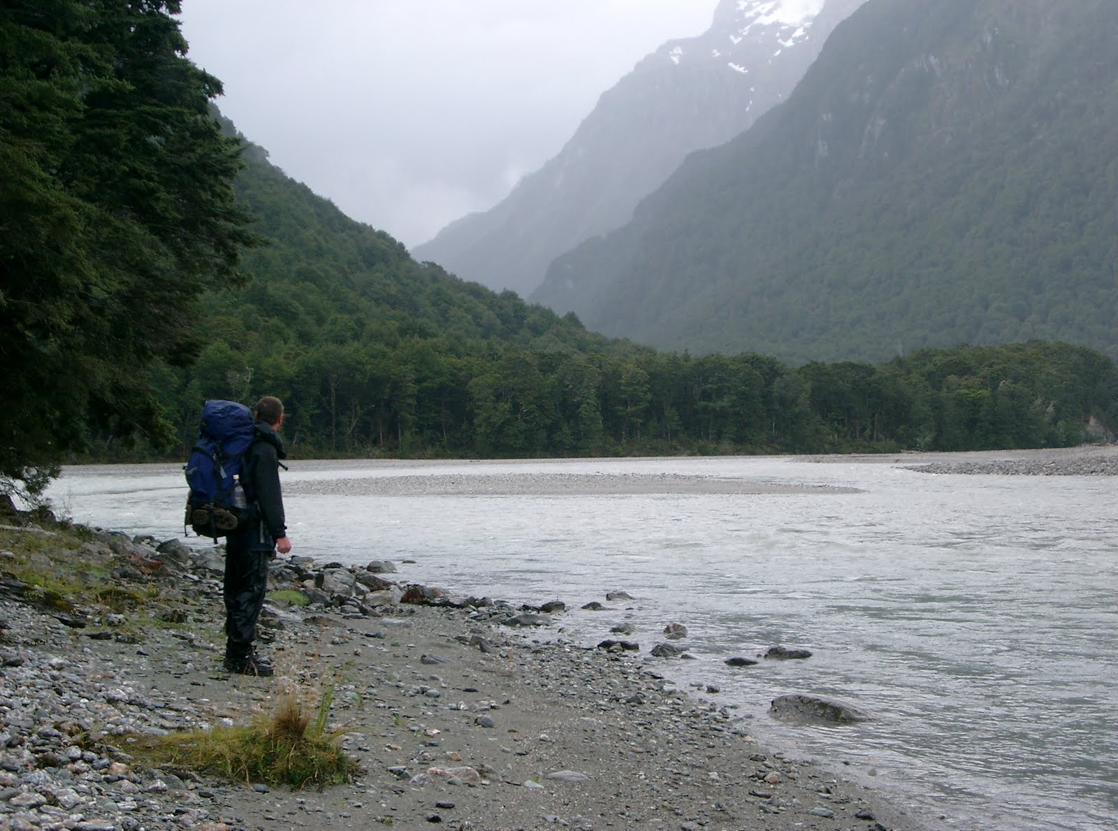
 Somewhere along the Beansbern.

 Looking back up the Dart River towards the beansbern.

 Day six was just a short pleasant bush walk out past lake Sylvan and back to The Routeburn Shelter to the car. A memorable trip and quite a popular one with the locals here, I know several people who have done it. A not to difficult moderate trip and most enjoyable. To date still the only extended multi day I have done.